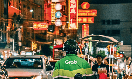
Recently, I had a minireunion with some of my secondary schoolmates on a trip to Penang to tackle the challenging 26-kilometre Penang Hill Unicorn Hike trail.
We had planned this trip for quite some time, initially mooted during the Chinese New Year’s reunion celebration. It was a good trip with almost 15 of us, hikers and non-hikers. While the hikers were focused on the hike itself, it was great that non-hiker friends could join us too for a few days of fun, food, and get-togethers in Penang.
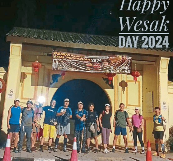
Our hike took place on Wesak Day, May 22nd. Most of us arrived in Penang from Kuala Lumpur on May 21st, after a must-stopover in Ipoh for a hearty lunch.
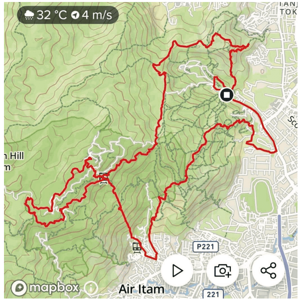
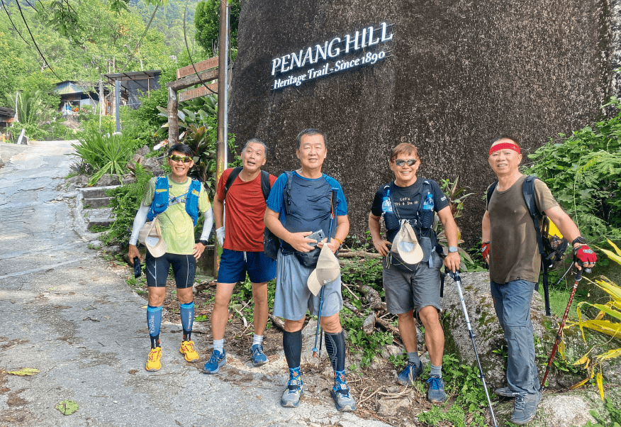
Unicorn Hike Trail on Penang Hill
The Unicorn Trail Hike
My doctor friend, who is based in Penang and who organised this trip, warned us that this is not an easy trail. It is a day-long hike, not the typical multi-day mountaineering experience with daily hikes of 6 to 8 hours each. The expected duration for this trail is a straight 12 hours, a dawn-to-dusk hike. Training and being reasonably fit are absolute prerequisites. We were also advised to be well equipped, especially with regards to having a good pair of shoes and carrying enough drinking water.
The fabled Unicorn Trail was mapped out in 2018 by some hikers with GPS-enabled smartwatches or smartphones, creating the line art of a prancing unicorn on the device. It is a hike that encompasses all the terrain imaginable, including rolling terrains, jungle trails, steep ascents and descents, flat routes, runnable paths, long and short staircases, tarmac roads, and cemented farm paths, among others. It is a daunting challenge, especially for non-hikers. The trail boasts an elevation gain of 1,400 meters and offers many scenic views and well-known checkpoints along the way, including the summit of Penang Hill.
 Botanical’s Moongate – The starting point
The Incredible Hike trail
6.15 am. Moongate, Botanical Garden, (Starting at the front leg of the Unicorn). We started our hike by assembling at the Botanical Garden’s Moongate. We were joined by our doctor’s friends, who were there for their daily short hikes. Altogether, there are ten of us. From there, we walked along the tarmac road for 2.1 kilometres to the Youth Park of Botanical Garden, which we were told is the common starting point and represents the front leg of the Unicorn.
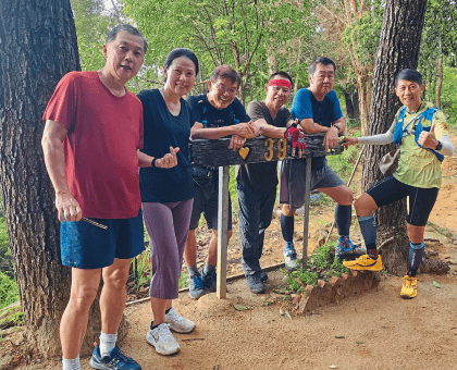
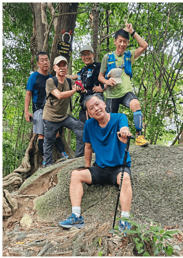
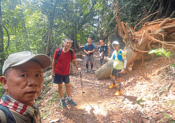
From left, Tuck Sing, Cheng, Dr Lim, Writer, Yun Koon, Siang Hwa at Station 39
From the Youth Park, we made our way into the forest reserve for our hike up to Station 3. It was still dark, so most of us had our headlamps on. The initial ascent was quite steep, with an elevation gain of approximately 500 meters after about an hour’s walk. Despite the early morning hour, it was humid, and beads of perspiration were already flowing down our faces.
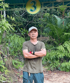 Writer at Station 3
7.10 am at Station 3 and onwards to Station 5 (The belly of the Unicorn). We reached Station 3 at 7.10 am, took a short break, and then continued onward to Station 5. Our targeted destination is Station 39. The ascending path, which included a pit stop and quick photos at Station 5, was a gradual incline in some parts and challenging terrain in others, with rocky and muddy trails in between. My doctor friend was quite a taskmaster in urging the team to keep moving and stick to our scheduled times. Along the way, we enjoyed panoramic views of the city below. We reached Station 39 at 8.00 am, marking the first major milestone. This is where short-trip hikers typically finish their hike and turn back. After a short break and the mandatory photo sign-off, we are ready to move and descend from Station 39.
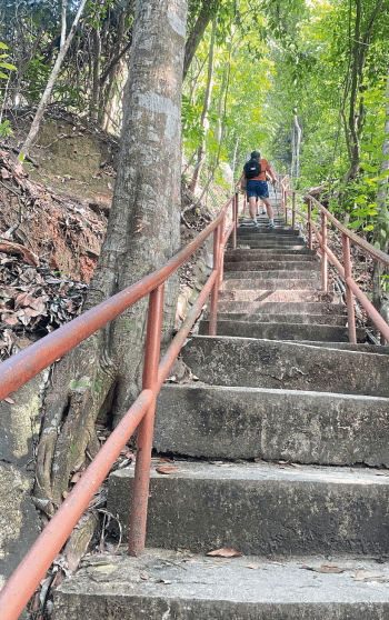 The Heritage’s trail staircase
8.00 am Descending from Station 39 (Down the hind leg of the Unicorn). As the morning brightened up, we descended onto our next destination, the Bukit Bendera base station, via the Hye Keat Estate trail. This was a difficult, steep, poorly marked trail littered with branches adorned with sharp thorns. At times, we had to grasp onto larger and sturdier branches for a more secure foothold before advancing. Our hiking poles proved to be invaluable in this section.
Eventually, we emerged from the jungle trail onto a cemented path. Descending along the cemented path was enjoyable, passing by durian orchards and exchanging greetings with many hikers, young and old, who were on their way up the same trail for their daily morning exercise.
 Resting at the base of Bukit Bendera
9.00 am at Bukit Bendera and going up Heritage Trail (Up the hind leg of the Unicorn). We finally made our way down to street level at 9.00 am and proceeded along the busy Jalan Bukit Bendera to the base of Bukit Bendera. We were told we had reached the belly of the Unicorn by this time. It was time for a pit stop to replenish our energy levels with snacks, energy bars, and electrolytes. Next on our agenda was the daunting task of tackling the Heritage Trail, an intimidatingly long flight of 1,440 uneven staircase steps. The thought of climbing these steps is intimidating, as it is equivalent to climbing five times the 272 steps to the temple at the top of Selangor’s Batu Caves. The staircase runs alongside the steep funicular railway track that ascends Penang Hill, up to an elevation of approximately 1500 meters. While we could have opted to take the train, doing so would defeat the purpose of the hike. And so, despite the daunting challenge, we pressed on, remembering the age-old adage that the journey of a thousand steps begins with the first step. It will be a straight ascent of approximately 700 meters.
 Enchanting Moniot Trail
10.40 am at Lower Station (At the back side of the Unicorn). After an exhausting and strenuous climb up in what felt like a never-ending staircase, we finally reached the top at 10.04 am. Looking back at the long flight of stairs that we had just ascended, the feeling was one of amazement and immense satisfaction. Despite our exhaustion, we still hadn’t reached the summit yet, and the journey continued towards the Lower Station, now under the blazing hot sun as the path was no longer shaded. We arrived at the Lower Station at 10.40 am and took a pit stop before continuing to the Middle Station.
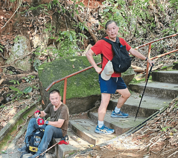 Taking a rest on the Heritage’s staircase
At the Middle Station, where we could see the passing tram overhead, we took a short break and regrouped before continuing our journey upward, this time offroad and back into the jungle. The trail zigzagged up, and though we were at a higher elevation now, it was still humid inside the jungle with mosquitoes for company. We reached Viaduct Train Station at 11.30 am, where we made another quick pit stop. From here, the walk was on what seemed like an abandoned tarmac road that led us to the entrance of the enchanting Moniot Trail.
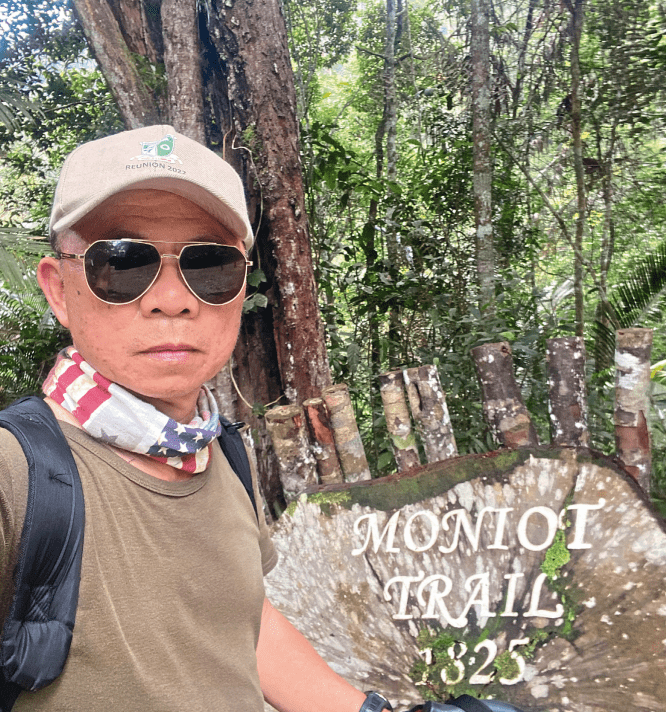
11.20 am at Moniot Trail entrance (The beginning of the Unicorn’s tail). Moniot Trail is one of the oldest trails on Penang Hill, completed in 1825 and named after surveyor general of the Straits Settlements, Jules M. Moniot. Some locals believe that “Moniot” is a British mispronunciation of the Malay word “monyet” which means monkey in English. The trail is as enchanting as its name, and the walk was pleasant in the tranquillity of the picturesque forest in the now cooler climate as we neared the summit. My doctor friend described the trail as akin to the one in the fairy tale of Hansel and Gretel.
 Writer at the Moniot Trail Exit
12.07 noon, At the summit of Penang Hill (Still at the tail of the Unicorn). After the enchanting Moniot Trail walk and a final climb up a flight of crudely earthen steps, we emerged from the jungle to reach Kopi Hutan Café at the summit of Penang Hill. What a relief it was to finally reach the summit, knowing that lunch and rest were just 2 kilometres away at Penang Hill’s food court. I remembered this stretch as a stroll from Kopi Hutan cafe to the food court, but after 6 hours of hiking, tiredness had set in, and the walk on this stretch of relatively flat tarmac road was laborious, with our movements zombie-like at times.
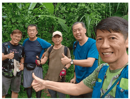
Mission accomplished, exit at Botanical Garden
12.30 noon Time for Rest and Lunch. Our non-hiker friends were at the food court to greet us. It was a welcome rest for our tired legs and an eagerly awaited, delicious lunch of fried kuey teow, ice kacang, and isotonic drinks. By now, we had completed about 18 kilometres of the 26 kilometres trail. Our doctor friend assured us that the worst was over and it would be easier from here onwards as we would be mostly descending. We cheekily reminded him that we had always placed our trust in doctors, so there was no reason not to believe him.
1.10 pm Time to move to Station 84 (Completing the tail of Unicorn). It was a quick lunch, though, as the doctor readied us to move again after the half-hour refreshing break. Our next destination was Station 84 via Path A, which would lead us to the Viaduct Train Station and complete the tail trail of the Unicorn. Here, it was mostly downhill on cemented paths and tarmac roads, which put some strain on our knees. At times, it felt better to walk in reverse. After a further short hike on the East Viaduct Road, through an inconspicuous descent on poorly labelled Path G with a few challenging slopes to negotiate, we reached Station 84.
2.30 pm Reaching Station 46 (Tip of Unicorn’s horn). From Station 84, it’s a stroll down the winding tarmac road to Station 46, where we regrouped before the final assault on the Unicorn’s horn. Our doctor friend was disciplined in ensuring that our breaks and pit stops were usually no longer than 5 minutes each for the whole trail.
We were soon to find out how challenging the final assault on the Unicorn’s horn would be. The tip of the horn is at the bottom of the ravine and to reach it, we had to descend a long and probably the steepest part of the whole Unicorn’s trail. There is no clear path, which means sometimes we have to negotiate through thick undergrowth, fallen tree trunks, and branches with sharp thorns. It was mostly a descent that needed ropes or our hiking poles to assist. In some parts, where the inclines were steep and there were no ropes, we had to grab and hold onto smaller tree trunks, branches, or larger tree trunk roots for support. It was a slow and tiring descent.
We were told the hardest part of the trail was hunting for the horn. Luckily our doctor friend had done the route before and was able to guide the group. As the energy level ran low and the knees began to hurt, it felt really good, after a 2-hour descent, to finally see the signboard “Anda di Hujung Tanduk Unicorn” (You are at the tip of the Unicorn’s horn). What a relief and a great sense of achievement!

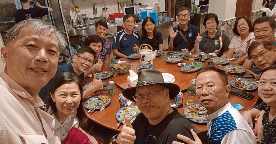
Dinner at the Doctor’s residence
4.15 pm at the tip of the Unicorn’s horn (To climb back the horn) Understandably, everybody was jubilant. After spending some time at the tip capturing the significant milestone in photos, it was time to climb back up the horn, the same way we had come down hours earlier. It would still take us about an hour to do that as we grabbed and pulled ourselves up to the top, onto a plateau, before we could descend on a home run to the Botanical Garden.
As we descended on the home run, we could see the overcast sky through the openings between the trees. Soon, we could hear the sound of thunder growling in the sky threatening to start the rain. But there was still daylight, and we were in good time, descending and nearing the end of the jungle trail, so it was not worrisome, though I wished I could move faster if not for the slight pain in my kneecap.
5.40 pm Exit at Botanical Garden (Completing the Unicorn Hike Trail) At 5.40 pm, we finally exited the forest into the Botanical Garden, marking the finish line of the Unicorn’s Hike Trail. There was a slight drizzle, and my knee hurt, but it didn’t matter, I had tamed the Unicorn with my friends.
Dinner get-together the night before
In Conclusion
I have to confess, that this was a tough and crazy hike. After completing the gruelling 12-hour hike from dawn to dusk, my device recorded a staggering 41,270 steps and 5,500 calories burnt. This challenging trail is certainly not for non-hikers or inexperienced hikers, as it requires thorough preparation. However, the feeling of accomplishment and satisfaction upon completion is unparalleled.
After the incredibly tough hike, my doctor friend generously hosted a grand dinner at his residence, welcoming hikers and non-hikers alike. It was a delightful evening gathering of old and new friends, sipping wine and whisky, chatting about our Penang trip, the food, the hike, reminiscing about old times, and enjoying each other’s company.